3D數值地形管理師-Terra Vista / Terra Vista Pro Builder
![]()
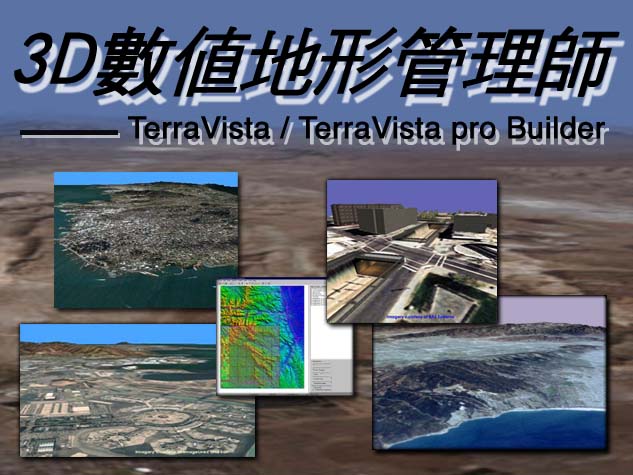
是一套windows-based操作相當簡單直覺,易學易用的三維數值地形編輯暨資料庫管理系統
![]()
1.圖形化的使用者介面,易學易用。
2.內建階層式資料庫,提供構建地形資料庫所需的物件與模型,使用者可以拖拉式(Drag &Drop)的方式加入新的物件或改變物件的屬性或改變物件的屬性。
3.地形向量可分別儲存於不同圖層,使用者可單獨對某一圖層做編輯而不會影響其他圖層。
4.支援多重視窗,讓使用者同時觀看多個視窗,使地形的編輯製作更迅速與方便。
5.多項專利技術,易學易用,資料正確,系統穩定,整體效能獲得最佳化。
| (1)SmartMesh TM |
| 自動解決不同LOD時的接合及破裂問題。 |
| (2)Automatic Feature Processors TM |
| 產生建築物的Footprint.自動產生輸配電於各電塔之間. |
| 可產生立體擬真的河流及湖泊。可產生道路或鐵路的凸起。 |
| (3)GeoPaint TM |
| GeoPaint會以最高解析度的LOD資料及使用者定義的地形向量為依據作曲樣計算,產生具有清楚邊界的貼圖。 |
| (4)TerraPage TM |
| 良好的空間結構處理,有助於地形的分割處理運算及資料存取。針對OpenGL三角網格的資料結構作前置處理及最佳化。 |
| (5)TerraCompress TM |
| 是利用wavelet壓縮技術,降低記憶體的需求,進而加速地形的處理速度。 |
6.支援多種地形格式(Elevation Data)
| ArcInfo BIL(.bil) |
| BiteMap: Image interpreted as 8 bitelevation data |
| DTED Levels 0,1,2(.dt0, .dt1, dt2) |
| ESRI Grid Ascii (.grd, .asc) |
ESRI Grid Float(.hdr) |
| GeoTIFF: Image interpreted as 16 bitelevation data |
| Govement of Spain(.sasc) |
| Govement of Sweden (.dis) |
| Japanese MEM (.mem) |
| USGS 1:250k (.dem) |
7.支援多種模型及向量資料
| 3D模型 |
| Openflight(.flt) , SEDRIS(.stf) |
| 向量資料 |
| DFAD All Levels, |
| USGS Digitaline Graph (.dlg), |
| USGS LandUse LandCover (.lulc) |
| ArcViewShape (.shp) |
| S-57 File (*.0*) |
8.支援多種影像格式
| 地形影像 (Imagery) |
| GeoTIFF (.tif) |
| ArcInfo World (.wrl) |
| TIFF (.tif) |
| JPEP (.jpg) |
| BitMap (.bmp) |
| NITF CIB (.i22) |
| 貼圖影像 (Phototextures) |
| RGB & RGBA (.rgb, .tgba) |
| TIFF (.tif) |
| GIF (.gif) |
9.Terra Vista Pro Builder除了擁有上述的功能,另外亦提供:
| (1)Sensor Support |
| 可產生Visual、IR、Radar、NVG、Semi-Automated and Map Display的對應(Mapping)地形資料庫。 |
| (2)資料庫整合(Database Correlation) |
| (3)TerraMap TM |
| (4)Semi-Automated Forces Output |
| 可以自動地將SAF型態的資料關聯到地型上去,並產生軍事地圖,MODSAF(.ctdb)是目前支援的SAF資料格式。 |
| (5)Database Automatic Re-use Technology (DART TM) |
![]()
Windows 95 / 98 / ME 或 Windows NT / 2000 / XP professional
![]()
For standard Terra Vista users: |
|
| Pentium III,1G HZ | |
| 512 MB or greater of RAM | |
| 32 MB Geforce 2 or equivalent card | |
| For Terra Vista Pro Builder users: | |
| Penutim IV, 1.6GHZ | |
| 1 GB of memory | |
| 64 MB GeForce 3 or equivalent card | |
| For DART or CTDB users: | |
| Pentium IV, 1.8 GHZ | |
| 1 GB of memory | |
| 64 MB Geforce 3 or equivalent card | |
點 子 科 技 有 限 公 司
E-mail:inform@pcexpert.com.tw